
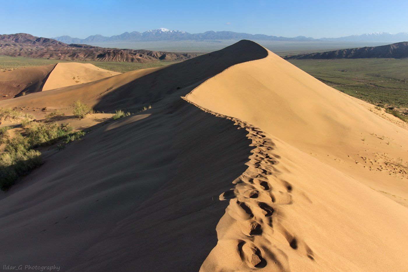
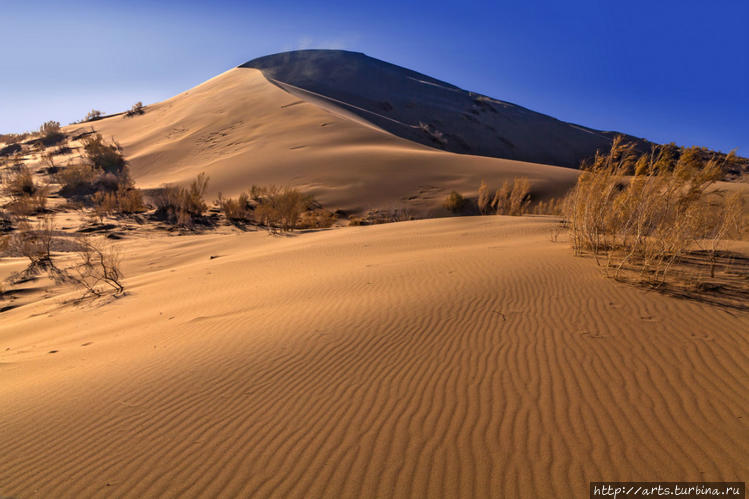
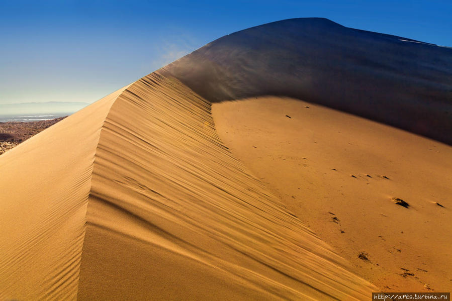


The Singing Barkhan is a mountain of light-colored sand, has a length of up to 3 km and a height of 150 m. east of Alma-Ata. The singing dune is a natural phenomenon, famous for the fact that in dry weather the sands emit a sound similar to the melody of a ringing organ. A beautiful view of the surrounding area opens from the dune. In the south, you can see a thin strip of the Ili River, the purple Sogety and Boguty mountains, behind which the Ketmen ridges look out with white peaks. From the west, the horizon is covered by the steep side of the Big Kalkan, from the east – by the Small. And in the north, behind it, you can see the lilac-blue ridge of the spurs of the Dzungarian Alatau, the Chulak, Matai and Altyn-Emel mountains. At their foot there is a piedmont valley, indented with thin strips of dry channels of rain streams. The southwestern slope of the dune is smooth, while the opposite one in the northeast has several ridges with gentle slopes. The Singing Dune is a popular tourist attraction. The dune was formed as a result of blowing sand from the shoals of the Ili River. In this part of the Ili river valley (between the Kalkans and the Boguty and Syugaty mountains) a strong wind blows, which raises clouds of sand dust from the river shallows. At the Big and Small Kalkans, standing at a slight angle to each other, the wind meets an obstacle and, weakening, leaves sand. So, over many millennia, a huge sandy mountain has grown. The dune does not wander across the plain, despite the unsteadiness of the sand and strong winds, but has remained in place for several millennia.
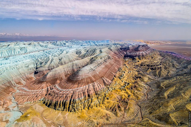
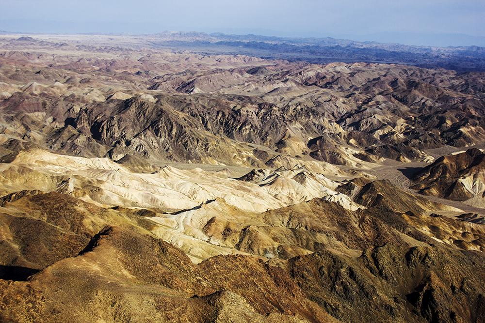
The Aktau mountains are chalk accumulations millions of years old. A very long time ago, this place was the Tethys Ocean. And now, from time to time, the remains of dinosaurs and prehistoric mammals are found here. They are the only witnesses of those distant times, when the Cretaceous Mountains were just emerging. This land amazes with its grandeur and at the same time lifelessness. Although hardy plants grow here, and the beauty of slender rams – Arkhans – is hard not to admire. Nature and wind have worked hard on this territory. As a result, Aktau are layers of sedimentary rocks of a slightly strange shape and with different colors on the tops. Cone-shaped mountains resemble Egyptian pyramids or some kind of alien multicolored stations. When the sun is shining, an incredible view of the mountains opens up. Hills of Aktau sparkle interspersed with white quartz, red jasper, pink carnelian. The landscape then takes on an enchanting, even unearthly beauty.
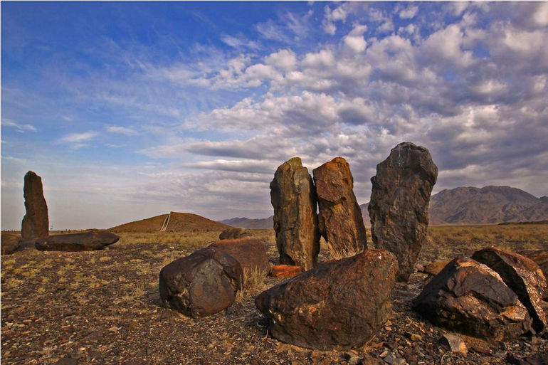
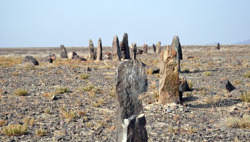
Besshatyr kurgan consists of many burial grounds dating back to the 6th-4th century BC. The total area of the Besshatyr burial ground is about 2 km². Big Besshatyr kurgan is the largest of the kurgans. Its diameter is 105 meters and its height is 17 meters. The mound has the shape of a truncated body, and due to the stone covering, which is densely packed in several layers at the base, the impression of a socle is created. The mound is spirally surrounded by 94 circular fences made of stone pillars-menhirs and large boulders. Tamgas of Kazakh clans are painted on some menhirs. In one of the burial mounds there was a wooden building made of massive trunks of Tien Shan fir trees. According to scientists, the Besshatyr complex was a sacred place for the Saka tribes, who for centuries performed funerals, various cult rituals and made sacrifices. The study of the burial mounds testifies to the extensive construction experience in the construction of mounds and dwellings using wood, stone, reeds and shrubs. From this we can conclude that the Semirechye Saks wandered only in the warm season, and with the onset of winter they went to wintering places. This gives new knowledge about the culture of the Semirechye Saka tribes.
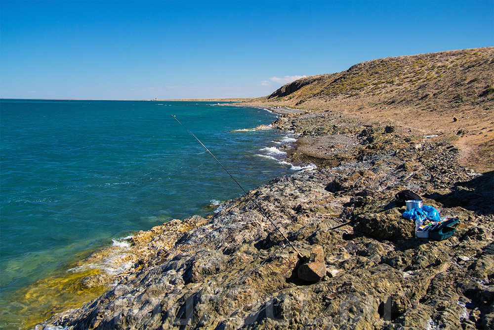
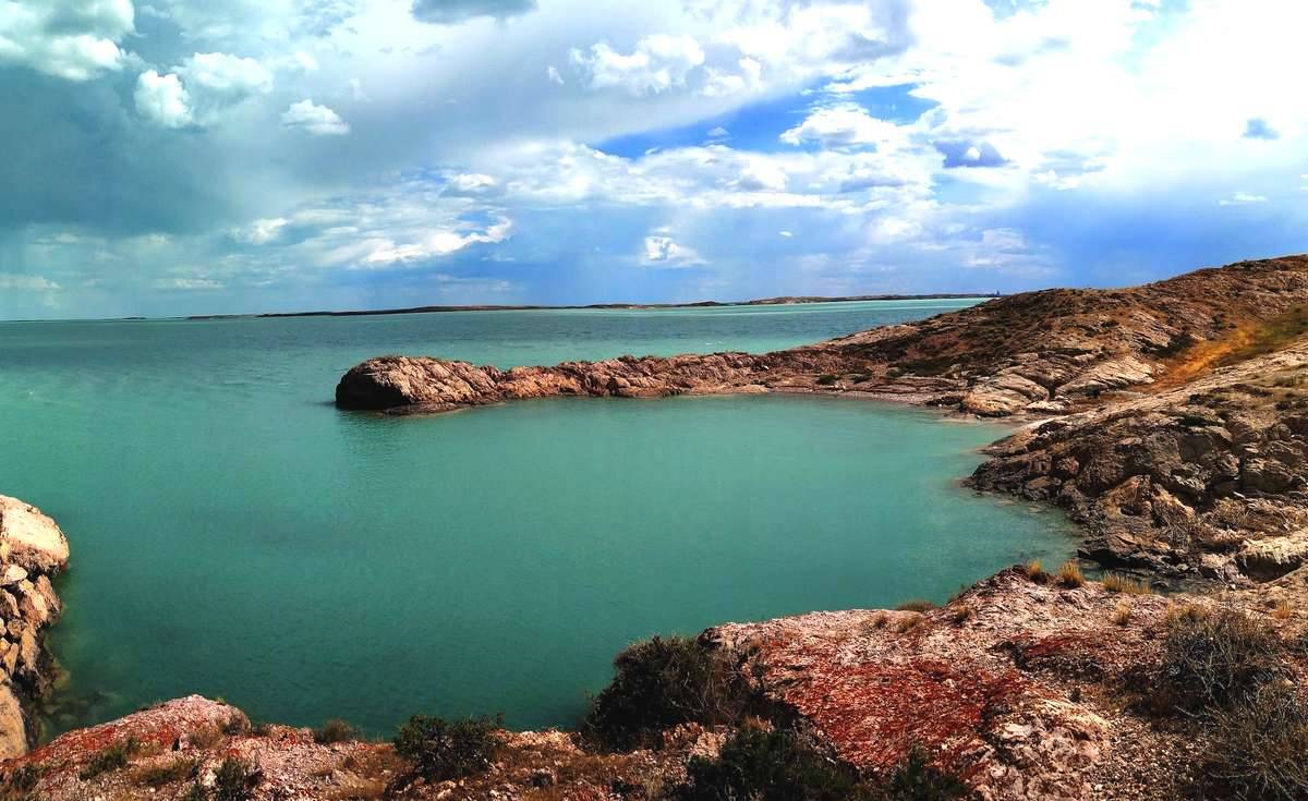
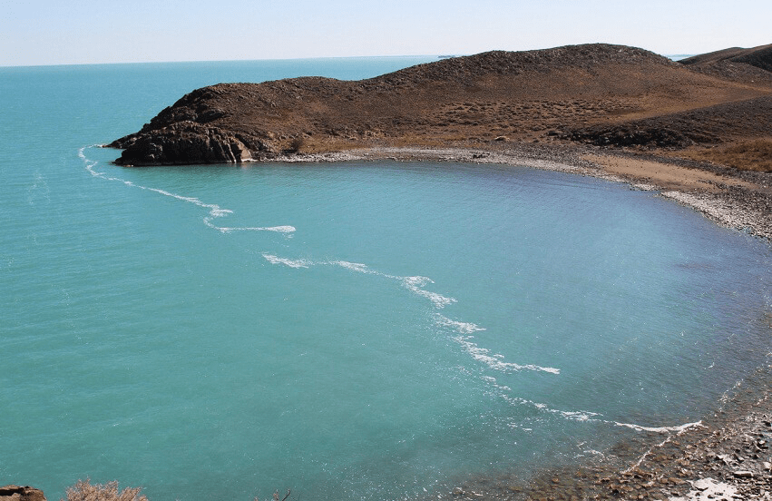
Balkhash is an endless semi-freshwater lake in the Balkhash-Alakol depression in the southeast of Kazakhstan, the second largest undying salt lake (after the Caspian Sea) and 14th in the list of the largest lakes in the world. The lake is divided by a narrow strait into two parts with different chemical characteristics of the water – in the western part it is practically fresh, and in the eastern part it is brackish. The lake belongs to the Balkhash-Alakol water basin and is located in three regions of Kazakhstan at once: Almaty, Zhambyl and Karaganda. To the north of the lake stretches the vast Kazakh Upland, to the west extends Betpak-Dala, and to the south are the Chu-Ili mountains, the Taukum and Saryesik-Atyrau sands. Popular types of recreation on Lake Balkhash are beach tourism and water sports: sailing, kayaking and canoeing, sport fishing. The recreational potential of the lake and the surrounding attractions (Bektau-Ata tract, tugai forests) attract numerous tourists, there are several boarding houses. Various sporting events are held as part of the lake conservation movement.
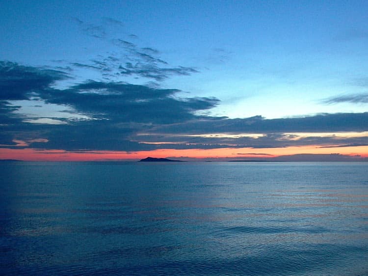
Alakol (kaz.Alakol, from ala kul – a bright, multi-colored lake) is a bitter-salty closed lake in Kazakhstan, located on the Balkhash-Alakol lowland, which is located on the border of the Almaty and East Kazakhstan regions, in the eastern part of the Balkhash-Alakol depression in the south -east Kazakhstan. To the southeast of the lake is the Dzhungar Gate Pass. It is known as the “healing lake”. On the western shore of the lake there are the resort villages of Akshi and Koktum, Akshi, 150 kilometers away, Koktuma, about 80 kilometers from the Kazakh-Chinese border. About 15 km east of Kabanbai is the Barlyk-Arasan balneological resort with the Dorozhnik rehabilitation center for cosmonauts. The sandy Barmakkum wasteland adjoins the coast from the northeast, but there are mineral springs on its outskirts.
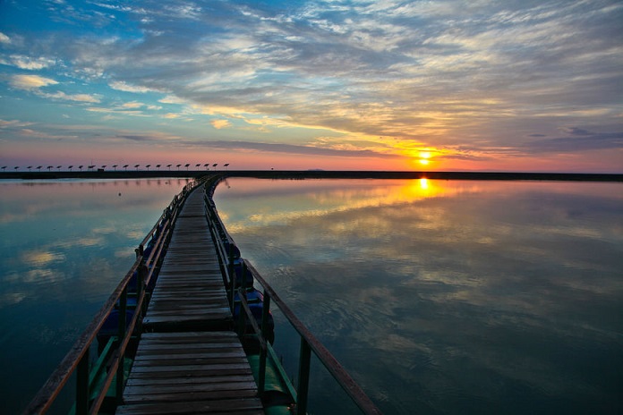
For 15 years, they have been trying to develop tourism on Lake Alakol. New recreation areas and boarding houses appear, which makes it possible to organize recreation according to different requests and means. However, the accompanying infrastructure is not yet fully developed. The service level is still insufficient. It is difficult to do something outside the recreation areas. The list of places where one could go on an excursion is limited to several objects, including the Dzungarian Gate and the “Devil’s Bridge” automobile crossing, Lake Zhalanashkol. The distance of the lake from big cities also plays a role. The journey from Almaty by bus or car takes 9-10 hours. It takes 16 hours to get to Koktum station by a special charter train, which runs from June to August.
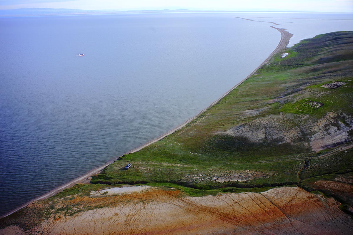
Zaysan (from Mong. Zaysan “prince”, also Zhaisan) is a lake in the east of Kazakhstan, in an open high and flat valley between mountain ranges: from the north-east – Altai, from the north-west – Kalbinskiy and from the south – Tarbagataiskiy. The Chinese border runs at a distance of 60 km from the eastern shore of the lake, from the Chinese side the Black Irtysh river flows and flows into the Zaisan [3]. The lake is located at an altitude of 420 m, its length is 105 km, and its width is 22-48 km, the maximum depth is 15 m. The water is fresh, soft and healthy. The mineralization of water (sodium chloride class) does not exceed 100 mg / l, the transparency is 1.3 m. The lake is covered with ice in November and opens up at the end of April. The bottom of the Zaisan is silty, in places sandy and covered with small pebbles. The shores are low, overgrown with reeds in a large area from the water, only near the Baklany and Barkhotsky capes is the coast clear. In some places, from mountain heights, capes enter the lake, of which, besides the two above, the most famous are: Vershinin, Golodaevsky, Topolevy, Sandy, Goliy.
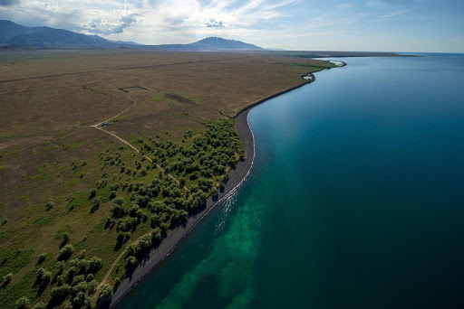
Bukhtarma reservoir is a reservoir formed by the dam of the Bukhtarma hydroelectric power station on the Irtysh river. The largest reservoir in Kazakhstan. It is one of the ten largest artificial reservoirs in the world in terms of area (5490 km², including Lake Zaisan), the largest reservoir in Kazakhstan. Located on the territory of the East Kazakhstan region of Kazakhstan. It occupies a large part of the Bukhtarma depression. The reservoir began to fill in 1960 with the help of the Bukhtarma hydroelectric power plant dam. Since 1966 it has been carrying out long-term flow regulation. The reservoir consists of 2 sections: the river one – along the Irtysh river valley, and the Zaisan lake, in the place of which a wide stretch was formed. In the western foothills of the Narym ridge, on the eastern coast of the Bukhtarma reservoir, two Paleolithic localities were found – Kurchum-1 and Kurchum-2. The ocherous clayey deposits, where the artifacts were found, correspond to the Ust-Uba Formation, the upper boundary of which is dated to ca. 1.8 million liters n. The underlying red clays may belong to the Pavlodar or Vtorushka Formation of the Pliocene.
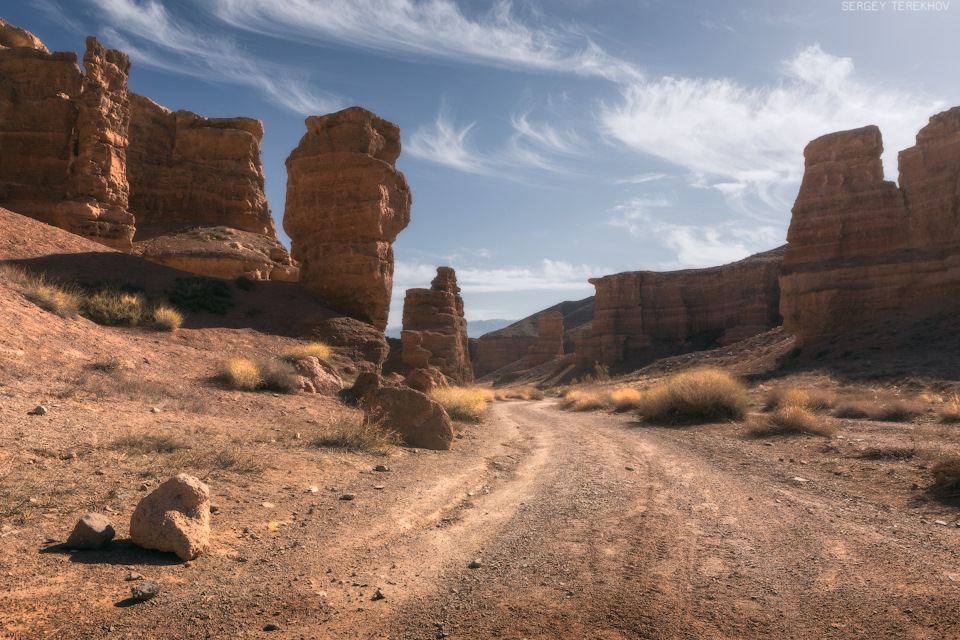
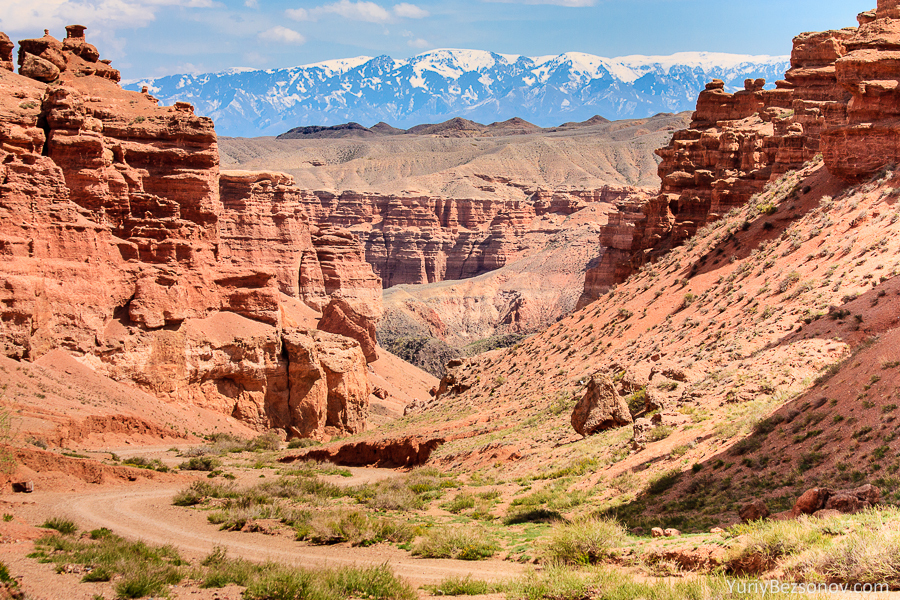
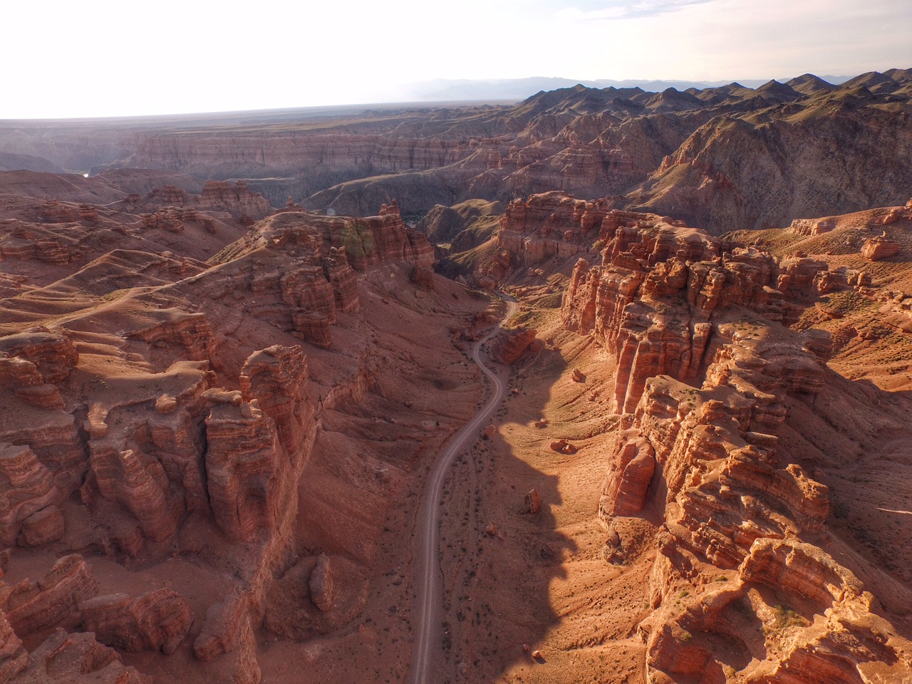
Charyn canyon is a 154 km long canyon along the Charyn River in Kazakhstan. The canyon is located 195 km east of the city of Almaty, not far from the border with China. It is located on the territory of three districts of the Almaty region: Uygur, Raiymbek, Enbekshikazakh. The canyon is part of the Charyn National Park, formed on February 23, 2004. The Red Canyon or “Valley of Castles” is a dry gorge washed out by melt water. It is located perpendicular to the Sharyn River, flowing through clay-sand mountains and stone rocks. The length of the Red Canyon is about 3 km, the width is from 20 to 130 m, and the depth is up to 100 m. The most interesting place for tourists is the so-called Valley of Castles, which is about 2 km long and 20-80 m wide. In the bosom of the canyon, there is a grove of a relict ash tree that survived the era of glaciation – Sogdian ash. Another similar grove is found only in North America. Since 1964 Ash Grove has been declared a natural monument. Also of great interest is the turang grove – the grove of the Asian poplar. The landscape diversity of the Charyn canyon determines the diversity of flora and fauna. More than 1500 species of plants grow here, 17 of which are listed in the Red Book of Kazakhstan and 62 species of mammals, 103 species of nesting birds, 25 species of reptiles.
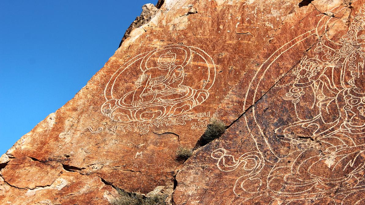
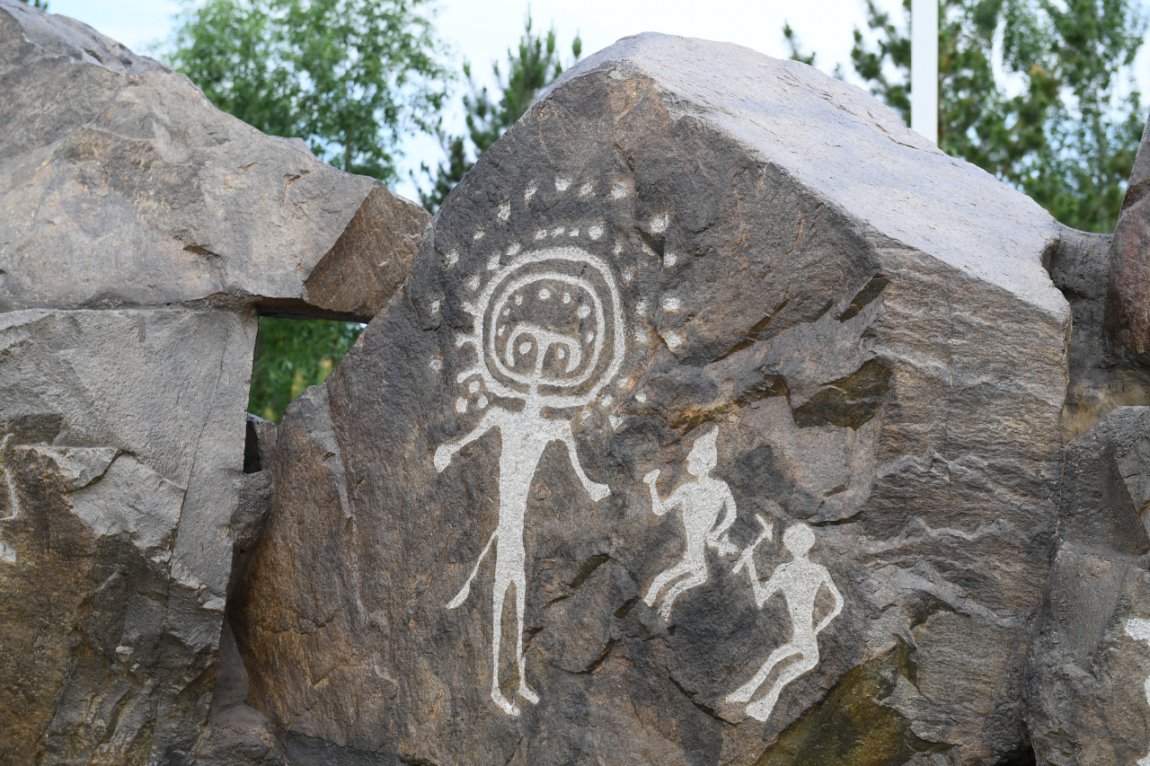
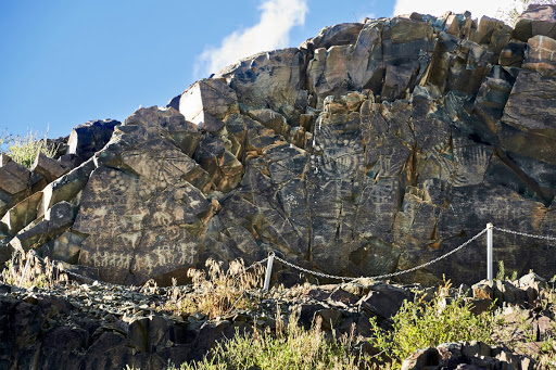
Tamgaly-Tas (“stones with signs / written stones”) is a tract near the Ili River, 120 km north of the city of Alma-Ata, where many petroglyphs, images of mysterious deities, and late Buddhist inscriptions have been preserved on the rocks. Among the petroglyphs, there are about a thousand rock images, among which the most famous are images of Buddha Shakyamuni, Buddha of Infinite Light Amitabh and bodhisattva of Infinite Compassion Avalokiteshvara. In addition to Buddhist drawings and inscriptions, there is a stone with ancient Türkic runic inscriptions of the 8th-9th centuries, presumably left by the Kipchaks. Tamgaly-Tas is under the protection of the government of Kazakhstan as a cultural monument and is an open-air Buddhist temple, as evidenced by a sign at the entrance to the tract.
| День № | Дата | Место | Действия | Расстояние | Места ночевок или обедов | |
|---|---|---|---|---|---|---|
| День 1 | 2020-09-16 | Мегадача (Табаган) | 15.09.2020 ставится лагерь. 16.09.2020 проведение анонсовой конференции с 10 до 12 часов. Отмечаем Мегадачу на карте как стоянку. Торжественный выезд в 12 часов. | 0 | Выезд в 12-00 | |
| День 1 | 2020-09-16 | ТамгалыТас | Отмечаем место под кемпинг на карте | 117 км; | Обед в 14-00 | |
| День 1 | 2020-09-16 | Сары-Озек | Отмечаем место под кемпинг на карте | 109 км; | ||
| День 1 | 2020-09-16 | Басчи | Отмечаем место под кемпинг на карте | 84 км; | ||
| День 1 | 2020-09-16 | Жаркент | Отмечаем места под парковку на карте | 119 км; | Ужин и ночевка в отеле | |
| День 2 | 2020-09-17 | Жаркент | Выезд в Чунджу | Завтрак. Выезд в 7-30 | ||
| День 2 | 2020-09-17 | Чунджа | Отмечаем место под кемпинг на карте | 99 км; | Обед в 13-00 | |
| День 2 | 2020-09-17 | Кегень | Узловая стоянка | 74 км; | Проезжаем | |
| День 2 | 2020-09-17 | Тузколь | Отмечаем место под кемпинг на карте | 79 км; | Ужин и ночевка в лагере | |
| День 3 | 2020-09-18 | Тузколь | Выезд в Саты | Завтрак. Выезд в 7-30 | ||
| День 3 | 2020-09-18 | Кегень | Узловая стоянка | 79 км; | Проезжаем | |
| День 3 | 2020-09-18 | Каркара | Отмечаем место под кемпинг на карте | 23 км; | Обед в 13-00 | |
| День 3 | 2020-09-18 | Кегень | Отмечаем узловую стоянку на карте | 23 км; | ||
| День 3 | 2020-09-18 | Бестюбинское водохранилище | Отмечаем место под кемпинг на карте | ————— | ||
| День 3 | 2020-09-18 | Саты (Кольсай) | Отмечаем место под кемпинг на карте | 102 км; | Ужин и ночевка в лагере | |
| День 4 | 2020-09-19 | Саты (Кольсай) | Выезд в Чарын | Завтрак. Выезд в 7-30 | ||
| День 4 | 2020-09-19 | Чарынский каньон | Отмечаем место под кемпинг на карте. Отмечаем музей (Нура) на карте | 97 км; | Обед в 13-00, ужин и ночевка в лагере. | |
| День 5 | 2020-09-20 | Чарынский каньон | Выезд в Алматы | Завтрак. Выезд в 7-30 | ||
| День 5 | 2020-09-20 | Малыбай | Отмечаем кемпинг Рафт Сервис на карте | 75 км; | Обед в 13-00. | |
| День 5 | 2020-09-20 | Гунны | Отмечаем Юрточный глэмпинг Гунны на карте и Тальхиз | 133 км; | ||
| День 5 | 2020-09-20 | Алматы | Отмечаем места под парковки на карте | 47 км; | Ужин и ночевка в отеле | |
| День 6 | 2020-09-21 | Алматы | Выезд в Аюсай ГНПП Иле-Алатау | Завтрак. Выезд в 9-00 | ||
| День 6 | 2020-09-21 | Аюсай | Отмечаем стоянку под кемпинг в Иле-Алатау | 21 км; | Обед, | |
| День 6 | 2020-09-22 | БАО | Промежуточное место | 13 км; | ||
| день 6 | 2020-09-22 | Аюсай | Отмечаем стоянку под кемпинг в Иле-Алатау | 13 км; | ужин и ночевка | |
| День 7 | 2020-09-22 | Аюсай | Выезд в Танбалы | Завтрак. Выезд в 7-30 | ||
| День 7 | 2020-09-22 | Дегерес | Промежуточное место | 126 км; | ||
| День 7 | 2020-09-22 | Копа | Промежуточное место | 37 км; | ||
| День 7 | 2020-09-22 | Танбалы | Отмечаем место под кемпинг рядом с Тамгалы на карте | 41 км; | Обед в 13-00 | |
| День 7 | 2020-09-22 | Мерке | Промежуточное место | 305 км; | ||
| День 7 | 2020-09-22 | Акыртас | Отмечаем место под кемпинг рядом с Акыртас на карте | 126 км; | Ужин и ночевка в лагере | |
| День 8 | 2020-09-23 | Акыртас | Выезд в Тараз | Завтрак. Выезд в 7-30 | ||
| День 8 | 2020-09-23 | Тараз | Отмечаем место под парковки на карте. Обед в ресторане и выезд в АйшаБиби | 50 км; | Обед в 13-00 | |
| День 8 | 2020-09-23 | Аксу-Жабаглы | Отмечаем место под кемпинг рядом с Аксу-Жабаглы на карте | 104 км; | Ужин и ночевка в лагере | |
| День 9 | 2020-09-24 | Аксу-Жабаглы | Выезд в Шымкент | Завтрак. Выезд в 7-30 | ||
| День 9 | 2020-09-24 | Шымкент | Отмечаем места под парковки на карте. Обед в ресторане | 91 км; | Обед в 13-00 | |
| День 9 | 2020-09-24 | Сайрам-Угамский парк | Отмечаем место под кемпинг в Сайрам-Угамский парке на карте | 111 км; | Ужин и ночевка в лагере | |
| День 10 | 2020-09-25 | Сайрам-Угамский парк | Выезд в Ак-Мечеть | Завтрак. Выезд в 7-30 | ||
| День 10 | 2020-09-25 | Ак-Мечеть | Отмечаем место под кемпинг на карте | 166 км; | Обед в 13-00 | |
| День 10 | 2020-09-25 | Арыстан Баба | Отмечаем место под кемпинг рядом с Арыстан Баба на карте | 164 км; | Ужин и ночевка в лагере | |
| День 11 | 2020-09-26 | Арыстан Баба | Выезд в Туркестан | Завтрак. Выезд в 7-30 | ||
| День 11 | 2020-09-26 | Отырар | Отмечаем место под кемпинг на карте | 15 км; | Обед в 13-00 | |
| День 11 | 2020-09-26 | Туркестан | Отмечаем места под парковки на карте | 58 км; | Ужин и ночевка в отеле | |
| День 12 | 2020-09-27 | Туркестан | Выезд в Сауран | Завтрак. Осмотр новых парковок. Обед. Выезд в 14-00 | ||
| День 12 | 2020-09-27 | Сауран | Отмечаем место под кемпинг на карте | 40 км; | Ужин и ночевка в лагере | |
| День 13 | 2020-09-28 | Сауран | Выезд в Луговое | Завтрак. Выезд в 7-30 | ||
| День 13 | 2020-09-28 | Луговое | Отмечаем места под кемпинг на карте | 456 км; | Ужин и ночевка в лагере | |
| День 14 | 2020-09-29 | Луговое | Выезд в Алматы | Завтрак. Выезд в 7-30 | ||
| День 14 | 2020-09-29 | Алматы | 391 км; | Ужин и ночевка | ||
| День 15 | 2020-09-30 | Алматы, | Отмечаем места под кемпинг на карте | 34 км; | Ужин и ночевка в лагере | |
| День 16 | 2020-10-01 | Алматы, Этно Центр Номад | Проведение завершающей конференции. Выезд в Алматы | Общий километраж - 3622 км | Завтрак. Конференция с 10-00 до 13-00. Обед. Выезд в Алматы в 14-30 | |